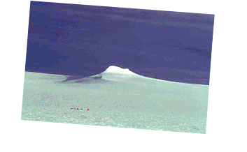
The President and primary staff of Geologic Mapping, Inc. is Pete Rowley (photo below). He works closely with many colleagues in academia and business. The resume of Pete is available on request. An abbreviated version of this resume, with photos, makes up this website. 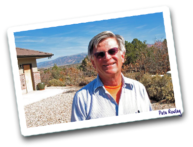 (Some of the pictures above are from five 4-month-long field seasons in Antarctica, the first where Pete was second in charge to Paul Williams, then three seasons that he led, then the last that he co-led with Brian Storey of the British Antarctic Survey using BAS logistics. During those 5 seasons, Pete and many colleagues geologically mapped more than 50,000 square miles of previously unvisited mountains, the last unexplored mountainous area on the Earths surface. Some other photos are from the eruption of Mount St. Helens in 1980, when Pete (the young man on the TV screen in a photo elsewhere) led USGS press conferences as Information Scientist in June and August and, with colleagues, mapped pyroclastic flows and related deposits from the five major 1980 eruptions and wrote reports for several years.)
RESUME — September 2021
PETER D. ROWLEY, Ph.D.
Geologic Mapping, Inc.
P.O. Box 651 (1235 South 500 East)
New Harmony, UT 84757
(435) 865-5928 Business Phone
(435) 590-1946 Cell Phone
(435) 865-5935 Fax
pdrowley@rushisp.com
www.geologicmappinginc.com
Education:
- Ph.D. in geology (6/1968)—University of Texas at Austin (9/1964-6/1968). Dissertation: “Geology of the southern Sevier Plateau, Utah;” advisor J. Hoover Mackin
- B.A. in geology (6/1964)—Carleton College, Northfield, Minnesota (9/1960-6/1964)
Honors and Awards:
| 2008: | Lehi Hintze Award for Outstanding Contributions to the Geology of Utah, for 2008, by the Utah Geological Association and Utah Geological Survey, for career accomplishments in Utah (given annually) |
| 1999: | Distinguished Achievement Award, for career accomplishments, Carleton Alumni Association, Carleton College, Northfield, MN |
| 1995: | Dibblee Medal, by the Dibblee Geological Foundation, for career accomplishments in geologic mapping and field geology (a national medal, given annually) |
| 1972-1987: | Principal Investigator of 6 National Science Foundation grants to the USGS, totaling $519,000, for field and stateside research in Antarctica |
| 1986: | Meritorius Service Award, Department of the Interior |
| 1986: | Named geographic feature: Rowley Massif, in the Black Coast of the Antarctic Peninsula |
| 1985, 1980: | Named fossils, Otazamites rowleyi (a cycad leaf), Retroceramus rowleyi (a pelecypod) |
| 1979: | Named a Fellow of The Explorers Club, New York, N.Y |
| 1990-present: | In Who’s Who in America, Who’s Who in the West, Who’s Who in America (Science and Engineering), International Leaders in Achievement, Men of Achievement, Who’s Who in Technology, American Men and Women of Science, Dictionary of International Biography, etc. |
Current Employment:
Consulting Geologist
Geologic Mapping, Inc. (this is an S Corporation of which I am the President)
From 5/2001 to present
Work in progress—
- Contractor to the Utah Geological Survey (UGS), Salt Lake City (2014 to present) for the following projects: (1) Prepare, as senior author, with Bob Biek of UGS, Dave Hacker of Kent State University, and others, the final published version of the Beaver 30 x 60 quadrangle (1:100,000 scale), which contains most of the Marysvale volcanic field; the preliminary version of the Beaver quadrangle was published under contract in 2005 but since then we found that the southern half of the quadrangle is underlain by three huge side-by-side Miocene gravity slides; the revision will be done by open filing the four quarters of the quadrangle at 1:50,000 scale, then do the final 1:100,000 sheet. The SW and NW quarters have been released (see list of publications elsewhere) in 2019 and 2020 respectively and the SE quarter was submitted in June 2021; the NE quarter will be done next fiscal year; (2) continue mapping and preparing reports, with Bob Biek and Dave Hacker, on the three gravity slides, the World's largest subaerial slide complex (Marysvale gravity-slide complex); the breakaways for all slides are in the Beaver quadrangle; several reports, including Field Guide 56, published in 2019 by the Geological Society of America, are part of a steady stream of discoveries on which we have published, and we led a GSA Thompson Field Forum in 2017.
- We are starting work with Larry Snee on a 3-year project to publish our long-unpublished maps and reports on the Caliente caldera complex, Nevada-Utah, to be done through the Nevada Bureau of Mines & Geology, with Jim Faulds, Director; Larry has about 90 Argon ages that never came out, and I have six 7.5-minute quadrangles on greenline in my files; work on these maps and reports was dropped in 1995 with the USGS Reduction in Force (RIF), with the project abruptly cancelled and both of us assigned to other duties.
- Contractor to Jay Grimshaw Drilling, Enoch, Utah (2020 to present), to provide expertise and analysis of the geology and geophysics of a geothermal-energy property he is leasing from the Bureau of Land Management (BLM) at Newcastle, Utah, intended for a power plant; I wrote an 11-page report in anticipation of Jay bringing in investors to develop the resource or to sell the project to a large energy company; the property is at the bullseye of the most promising part of the Newcastle geothermal area.
Jobs completed:
- Contractor to Alpha Engineering, St. George, to site production culinary water wells for cities and towns in southern Utah (2016-2021): listed in order from most recent, these were for Hildale, Hurricane, Kanab, Pine Valley, and Winchester Hills.
- Contractor to Southern Nevada Water Authority (SNWA)/Las Vegas Valley Water District (LVVWD), Las Vegas, to provide the digital geologic and geophysical framework to allow assessment of the effects of pumping, to determine and support applications for groundwater in meetings with the Nevada State Engineer, and to aid groundwater flow models of Spring, Cave, Delamar, Dry, and Snake valleys and other basins in Nevada and Utah (2001-2016). This was done by preparing 1:250,000-scale digital geologic and hydrogeologic maps, cross sections, and map explanations; by analysis of flow paths and hydrogeology; by preparing geologic reports; by providing expert-witness testimony; and by helping site production well fields. Collaboration with Gary Dixon (deceased) of Southwest Geology LLC, Blackfoot, Idaho as well as with hydrologists of SNWA and geophysicists of the USGS, Menlo Park. Many reports resulted, with a large final summary report published in 2017 by the Nevada Bureau of Mines & Geology of an area in Nevada and Utah of 25,000 miles2. SNWA abandoned the project in 2016.
- Contractor to Washington County Water Conservancy District (WCWCD), St. George (2002-2019), to provide, with the help of collaborators that included Gary Dixon, about 17 large to small projects that required reports, some published in the WCWCD series and, in addition, some in peer-reviewed annual publications of the Utah Geological Association; listed in order from most recent, these included such topics as: analysis of falling flows in a culinary spring for a small community; the hydrogeologic analysis of the Ash Creek drainage basin, which extends north-south for 30 miles (15 miles wide) along the I-15 corridor between Kanarraville in Iron County and the Virgin River in Washington County, and contains important groundwater resources; sited 28 shallow water wells, primarily for dust suppression, along the potential Lake Powell pipeline to St. George; analysis of a water well in Diamond Valley for possible purchase by WCWCD; additional analysis of Pah Tempe Hot Springs, the most saline and one of the largest hot springs in Utah, which WCWCD had acquired after bankruptcy of the Pah Tempe Hot Springs Resort; made a geologic map (scale 1 inch = 500 feet) and sited a production water-well field at the planned site of the Anderson Junction Reservoir, to be a 0.75-mile-long by 0.5-mile-wide reservoir northwest of Toquerville, UT, to be constructed to collect surface water to artificially recharge the Navajo Sandstone aquifer beneath the reservoir, as well as studying the adjacent Cottam well field to site another production well tapping the Navajo; sited a production water well on the south side of Kolob Reservoir, NW of Zion National Park; analyzed falling water tables and sited a production water well in the Diamond Valley subdivision; sited two production water wells along the Hurricane fault east of Pintura; provided hydrogeologic analysis, wrote 3 reports and affidavits, gave an expert deposition, and was scheduled to testify as an expert witness for a lawsuit by Pah Tempe Hot Springs Resort, near Hurricane, but it was settled out of court; with colleagues, made a 1:75,000-scale digital geologic map and wrote a geological/engineering report of the 120-mile route of a planned water pipeline to bring culinary water from Lake Powell to the Sand Hollow Reservoir and well field southwest of Hurricane; with colleagues, made 1:12,000-scale digital geologic and potentiometric-surface maps of a 35-square-mile area and sited new wells at the Sand Hollow Reservoir, a 1.5-mile by 0.6-mile artificial-recharge reservoir southwest of Hurricane that recharges the underlying Navajo aquifer; analyzed the reason for falling production in the town well field of Rockville; analyzed the reason for falling water tables in the rapidly growing community of Apple Valley, east of Hurricane; analyzed Sullivan’s well near Leeds, a production well drilled by WCWCD that is flowing under artesian pressure and producing more water than they had originally predicted; provided hydrogeology expertise and wrote the hydrology chapter of the Environmental Assessment for the Santa Clara Pipeline from the Gunlock well field; analyzed the effects on Pah Tempe Hot Springs, Inc. of a WCWCD pipeline that diverts the Virgin River around the highly saline water of these hot springs.
- Contractor or pro-bono mapping and publishing for the Utah Geological Survey, Salt Lake City to: (1) assist pro-bono Bob Biek of UGS with the Panguitch 30' x 60' quadrangle (1:100,000 scale), including mapping the Brian Head 7.5-minute quadrangle as senior author (1:24,000 scale) (2009-2015); (2) contractor to geologically map (1:12,000 scale) the Sulphurdale geothermal-resource area south of Cove Fort, the site of one of four geothermal power plants in Utah; published report in 2013; plant replaced in 2013 by a larger plant, by Enel North America, using binary technology (2010-2013); (3) contractor to map the 3-mile wide strip (1:24,000) making up the Utah part of the Deer Lodge Canyon, Prohibition Flat, Uvada, and Pine Park quadrangles, to be affixed to the west edge of the Cedar City 30 x 60 quadrangle (2008); (4) contractor to geologically map the Goldstrike and Utah part of the Docs Pass quadrangle (1:24,000 scale), and to assist (as second author to Bob Biek) the geologic mapping of the St. George 30 x 60 quadrangle (1:100,000 scale) (2005-2007); (5) contractor to geologically map the Beaver 30 x 60 quadrangle (1:100,000-scale) (2003-2005); and (6) contractor to geologically map the Cedar City 30 x 60 quadrangle (1:100,000-scale) (2002-2006).
- Subcontractor to David Black of Rosenberg Associates, St. George, and also collaborating with David Simon of Simon-Bymaster of Bountiful, for a surface-fault-rupture-hazard evaluation of: (1) Utah Dept. of Transportation highway interchanges for the 4-lane Southern Parkway, a State beltway bypass around greater St. George funded by President Obamas 2009 stimulus program; the interchanges are crossed by the active Washington fault; the evaluation required a detailed geologic map that I did, followed by 14 trenches across it and related faults that Dave and Dave did (2009-2011, published in 2015); (2) a SITLA (State of Utah School and Institutional Trust Lands Administration) 1000-acre property north of Washington City, Utah, crossed by the active Washington fault and under consideration for a housing development; I did a detailed geologic map, resulting in cancellation of the development before the trenches were done (2008-2009).
- Subcontractor to Southwest Geology, LLC to geologically map (1:100,000 scale) the Smoke Creek Desert and parts of adjacent ranges, Nevada and California, to aid hydrologists with their groundwater flow model of the basin and to site a production well field for a water-cooled coal-fired power plant to be built by Sempra Energy (2004-2005); project cancelled as coal went out of favor, and our report and water resources were sold to a housing developer (2004-2005).
- Contractor and temporary employee to the Colorado Geological Survey, Denver, to: (1) geologically map half the Cascade 7.5-minute quadrangle, CO, and to help prepare it for publication (2002-2003); and (2) as Physical Science Researcher III on a 6-month detail, to geologically map the Cheyenne Mountain 7.5-minute quadrangle, CO, and prepare it for publication (2001, both maps published in 2004).
- Contractor to the Ely office of BLM to provide geohydrology expertise for BLM staff and technical review of the Environmental Impact Statement (by CH2M Hill) for the proposed gas-fired Toquop Power plant, Tule Desert (northwest of Mesquite), Lincoln County, NV (2001-2003); EIS published but not enough water granted by the Nevada State Engineer, so project abandoned.
- As consultant, I have also solved single, short-term problems of various types, requiring site mapping, literature and aerial-photo work, and reports (2001-2017). Topics included siting production culinary wells for the towns of Panguitch, Brian Head, Leeds, Fernley-Nevada, and Mount Holly Ski Area east of Beaver; siting wells for private landowners, as near Paragonah, Cedar City, New Harmony, Motoqua, Kanarraville, Virgin, Hildale, Zion National Park, and Pintura; and siting wells for developers, as near Kanarraville, Apple Valley, Mount Pleasant, New Harmony, Enterprise, and Dameron Valley. Mapping several square miles near Minersville to analyze its potential for lead-zinc-silver deposits led to discovery of a sharply uplifted fault block and a large Miocene landslide off it, published for fun in 2014. I wrote reports for lawyers and landowners litigating such things as destruction of a spring in St. George, water rights in the Diamond Valley development, and interference in water yields by later wells near Summit and New Harmony; in the last of these studies, my mapping revealed a textbook example of fracture flow, in which four wells and a spring sited on the same fault zone interfered with each other (conduit groundwater flow), whereas three wells and a spring on opposite sides of other faults did not (barrier flow), published for fun in 2012. I worked with engineers on dam safety due to faults at Enterprise Reservoir and Piute Reservoir. I was subcontractor to Anteon Inc. on a grant from BLM concerning the hydrogeologic controls of two endangered plants in Carson Slough, near Death Valley Junction, California, resulting in a 65-page report. I wrote short reports for BLM on the geomorphology of a new archeological site and the geology of a quarry worked by ancestral Indians for obsidian, both on BLM land in Lincoln County, Nevada.
Previous Employment:
- Geology professor (full-time, temporary)
Dept. of Physical Science, Southern Utah University, Cedar City, UT
From 8/2000 to 5/2001
Courses taught: Natural Hazards, Environmental Geology, Mineralogy, Field trips to Marysvale volcanic field UT and Caliente caldera complex NV, Optical Mineralogy, Igneous Petrology- Geologist
U.S. Geological Survey, from 8/1970 to 8/2000, at Denver, CO (1970-1997), Las Vegas, NV (1997-1999), and Southern Utah University, Cedar City, UT (1999-2000). Highest grade attained, GS-15 (1981)
Thirty years of experience in research, leadership, and management, mostly in four areas: (1) Co- Project Chief (with G.L. Dixon), Nevada Test Site/Las Vegas Urban Corridor Project (1995- 2000), a large (about 30 employees), mostly outside-funded (we built it up to about $3 million/year) project dealing both with the contamination of the Death Valley ground-water flow system by about 800 underground nuclear tests and with the geology and hydrology of the fastest growing area (Las Vegas) in the country; (2) Project Chief of geologic studies in many areas and mining districts in Utah and Nevada (1970-1995), including the Caliente caldera complex, NV, Delamar, Pennsylvania, Easter, and Chief mining districts, NV, Marysvale volcanic field, UT, Iron Springs mining district, UT, eastern Uinta Mountains and Uinta Basin, UT-CO, and the Black Mountains and Mineral Mountains, UT; (3) several roles dealing with the results of the 1980 eruptions of Mount St. Helens, WA, including USGS Spokesman (June 9-22, August 7, 1980) and Project Chief of research on the 1980 pyroclastic flows and other topics (1980-1982); and (4) second-in-charge (1970-71) then Field Party Leader and Project Chief (1972-73, 1977-78, 1984-85, 1986-87) of remote expeditions to Antarctica in which we geologically mapped about 50,000 mi2 (the last unexplored mountainous parts of the Earths land surface) and then did stateside research and writing.- Assistant Professor (full time, temporary)
Dept. of Geology, Carleton College, Northfield, MN
From 9/1969-7/1970
Courses taught: Mineralogy, Environmental Geology, Igneous and Metamorphic Petrology, and Structural Geology- Temporary Instructor (full time, temporary)
Dept. of Geology, Kent State University, Kent, OH
From 9/1968-6/1969
Courses taught: Volcanology, Geomorphology, and Physical Geology
Current License:
State of Utah Professional Geologist (PG) License 5244263-2250 (1/02/2003-present)
Membership in Professional Societies:
- Geological Society of America (1963-present), Fellow (1979)
- Colorado Scientific Society (1970-1998); Membership Chairman, 1975-77
- Utah Geological Association (1973-1978, 1999-present)
- Rocky Mountain Association of Geologists (1974-1998)
- American Geological Institute (1970-present)
- Society of Economic Geologists (1977-2008)
- The Antarctican Society (1978-present)
- The Explorers Club (1979-1985), Fellow (1979)
- American Geophysical Union (1988-present)
- Geological Society of Nevada (1992-2009)
- Association of Engineering Geologists (1997-2007)
- Dixie Geological Society (1999-2012) (President in 2002)
- Nevada Water Resources Association (2007-2017)
Designed and programmed by