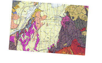
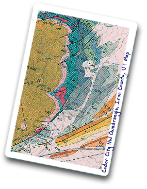
Geologic Mapping, Inc. provides a full range of geologic and ground-water hydrologic consulting services. Our expertise is based on broad experience, not only in all aspects of the geological sciences, but also in regional experience throughout the Western U.S. and other areas. We are based in the small town of New Harmony, southwestern Utah, which looks east across the Hurricane fault zone to the northern tip of Zion National Park. New Harmony is between Cedar City and St. George, Utah, and is centrally located with respect to other parts of the Southwest, including Denver (600 miles away), Las Vegas (150 miles), Los Angeles (400 miles), Phoenix (400 miles), and Salt Lake City (250 miles). We collaborate with a wide variety of senior scientists in other fields and locations, who provide help and expertise in additionally broad areas. In our analysis of geologic and hydrologic problems, we rely on geologic maps, whether those of others or those we make. The images above and below present an assortment of geologic maps and geologic cross sections that we have published.
Business Philosophy: To produce useful reports and to issue objective advice at deadline on a wide range of practical topics in geology and ground-water hydrology. Our geologic studies, which specialize in field work, deal with real-world applications of these two scientific fields. In other words, solving problems and studying issues relevant to practical concerns are emphasized. Assessments and reports are done at the highest professional standards and are understandable to both the professional and the layman.
Business Products Offered:
- Application of geologic knowledge to solving practical problems, done by a senior scientist
- Reports done at deadline, written at the highest professional standards, applying solutions to the problem at hand, and understandable to the professional and layman
- Geologic mapping, any scale, Western U.S.A.
- Geologic framework of ground-water flow systems, effects of pumping, and siting of production well fields
- Expert-witness testimony in courts and public hearings on many geologic topics
- Hazard assessments, including potential rupture of building sites by faults and landslides
- Mineral-resource and geothermal-energy-resource exploration and assessment, all types
- EIS and EA reports to satisfy Federal/State environmental compliance requirements (NEPA, CEQA)
- Technical reviews of geologic and hydrogeologic documents
Senior-Scientist Expertise:
- Expert on the geology of southwestern Utah and southern Nevada
- Broad regional knowledge of the geology of the Western U.S.A., notably the Great Basin and other parts of the Basin and Range province, as well as the Colorado Plateau and Rocky Mountains
- Geologic mapping experience in Utah, Nevada, Colorado, California, Wyoming, Mount St. Helens, Antarctica, and Saudi Arabia
- Specialties: geologic framework of ground-water flow systems; structural geology, especially faults and their geophysical interpretation; metallic mineral deposits; and volcanic and other igneous rocks
- Familiarity with present-day (Quaternary) sediments and landforms, including engineering implications, geomorphology of archeological sites, and potential impact on building sites by geologic hazards
- Dealing with the TV, radio, and print media, based on running press conferences during the 1980 eruptions of Mount St. Helens and in work with reporters on other topics
![]()
Designed and programmed by